
Transforming Urban Transit with RMTS
RMTS (Rajkot Mass Transport Service) is an innovative digital platform developed using .NET for both the frontend and backend, with SQL Server as the database. The application empowers users to enter their starting and ending points to search for available bus routes. It then displays a variety of bus cards representing different routes, providing a seamless and intuitive planning experience.
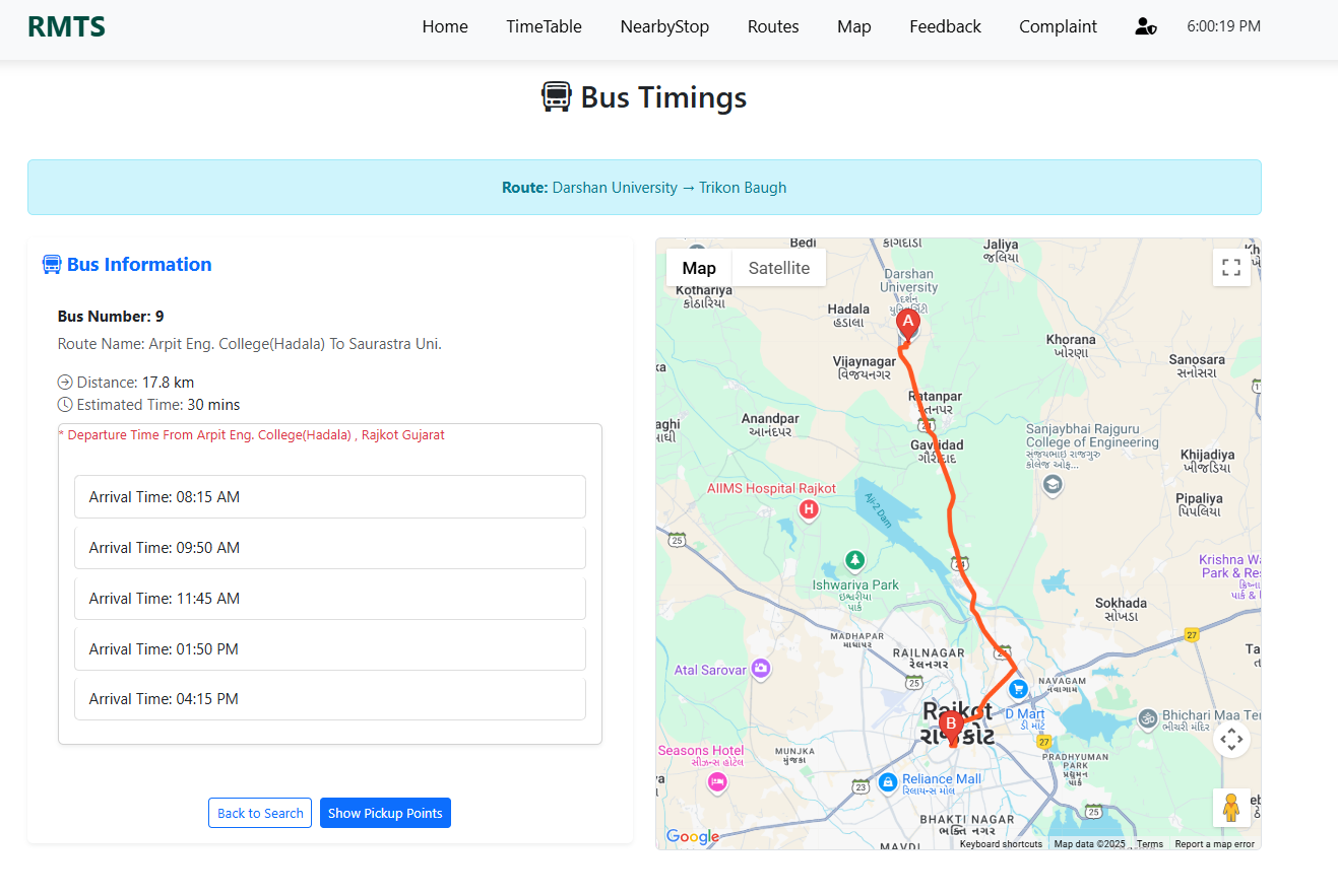
By clicking on any bus card, detailed route information is revealed—including distance, estimated travel time, dynamic directional maps, and expected arrival times. The platform further enhances user experience by automatically detecting the user's current location to display nearby pickup points within a 3 km radius, complete with precise distance metrics, making public transport more accessible than ever.
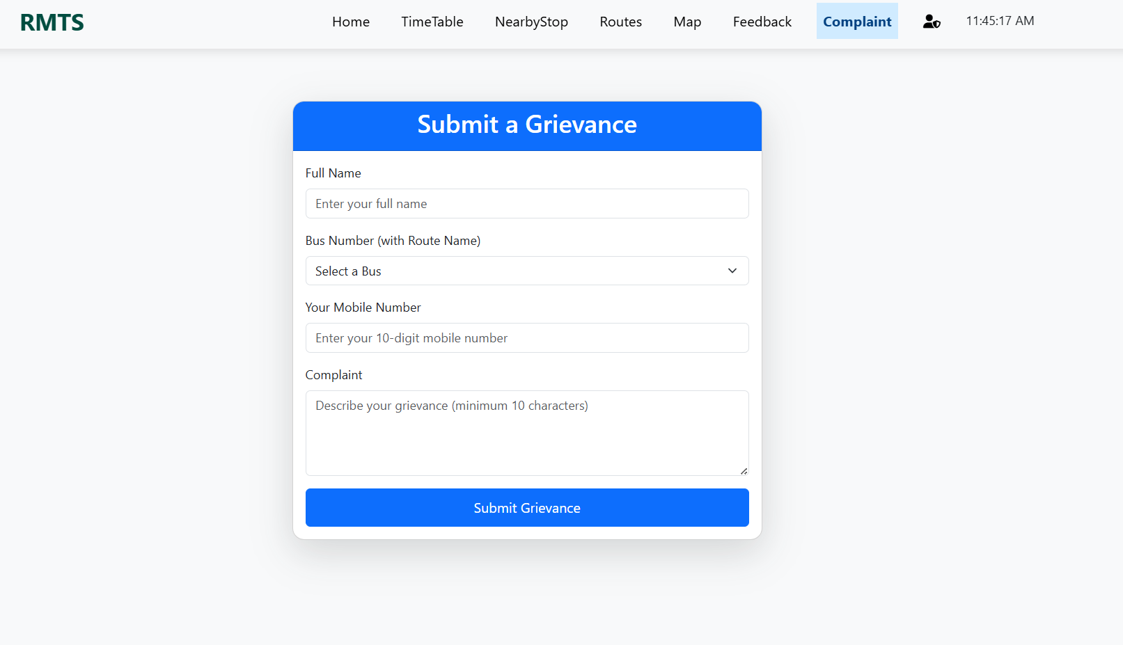
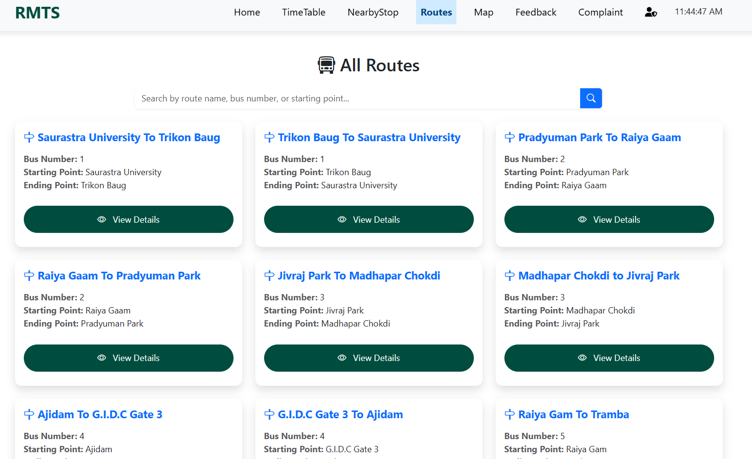
Additionally, RMTS provides a comprehensive listing of all Rajkot routes with detailed information, ensuring users have all the necessary data at their fingertips. It also incorporates an integrated complaint and feedback section where users can easily select a bus number to register issues and share valuable feedback, fostering continuous improvement in public transport services.
Key Features
- Input start and end points to search for optimal bus routes
- Dynamic display of bus cards with quick-view route details
- Detailed view showing distance, travel time, map directions, and real-time arrival estimates
- Automatic current location detection with nearby pickup points (within 3 km radius)
- Comprehensive listing of all Rajkot routes with detailed information
- Integrated complaint and feedback section for bus-specific issues and suggestions
Technical Implementation
RMTS is built using a robust .NET framework for both the frontend and backend, ensuring a highly scalable and secure application. SQL Server efficiently handles all data management, providing reliable data storage and retrieval. The system leverages advanced geolocation services and modern mapping libraries to offer dynamic route planning, accurate current location detection, and interactive navigation maps. Furthermore, its modular design seamlessly integrates a user-friendly complaint and feedback module, enhancing overall user interaction and service quality.